TIDEPOOL

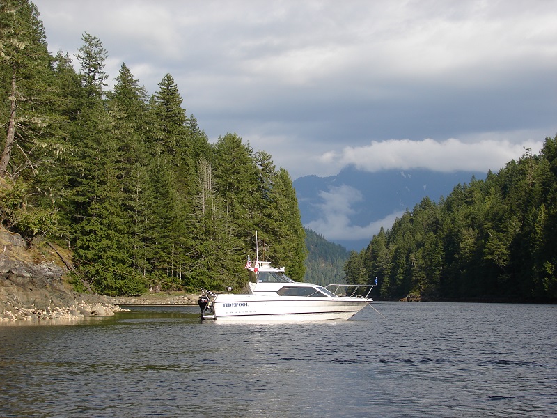
The Mexico trip is long over, Bright Water is sold, and sold again, but we’re still boating in the Pacific Northwest in TIDEPOOL, a 24′ Bayliner we bought new in 1997. TIDEPOOL has all the essentials for PNW boating:

It’s fast so we can beat or mostly ignore tides (cruise at 24-26 kts).
Plenty of range (120 miles or so).
A windshield and heater.
Big windows to overcome winter gloom.
An enclosed head with plenty of tankage.
Separate cooking, eating, and sleeping areas (at least for two people).


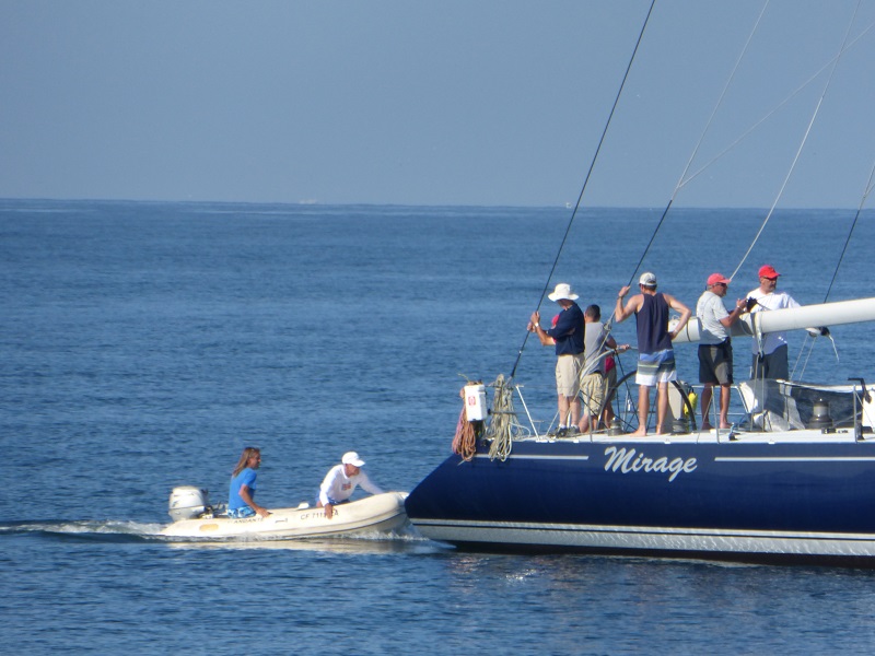
We don’t usually post trip photos here, because they’re less epic, but we have been asked to document the boat and the experience, so this will be a longish post.

Nobody would call TIDEPOOL beautiful, but boyoboy is she useful. Her main skill is waiting. She sits on a trailer and doesn’t cost anything at all when we’re not using her (that’s changed at little, see below.) She’s easy to launch and retrieve and work on in a covered barn.

The dingy on the left was the original purchased in 1997 from West Marine. Cheapest PVC rollup they made. The dingy on the right was the replacement purchased in 2019 from West Marine. Cheapest PVC rollup they made. The original was still completely fine, by the way. The PVC was not sun damaged at all. Both get wiped down with 303 UV protectant at least annually.

However, there were many many patches in the tubes from oyster shell cuts, so we started fresh. You can see the Honda 2 outboard on a transom bracket, behind the 4-stroke 15 horse Mercury kicker. The tiny 4-stroke Honda is air cooled, almost trouble-free, very light, and powerful enough to plane either dingy with one person on board.

These dinghies are super-light so they’re easy to carry above the high tide line when we go for a hike.

TIDEPOOL has an enclosed standard marine head and a 20 gallon black water tank. It came with a macerator discharge pump that eventually clogged or wore out or something, so we simply plumbed in a great big ball valve and some big sanitary hose. We only dump in approved/allowed areas, of course. Of course. Absolutely.

TIDEPOOL came with a 5.7L Mercruiser and Alpha sterndrive, with fresh water cooling (antifreeze inside the block, raw salt water cools the antifreeze and exits out the exhaust system). The exhaust risers leaked saltwater into the block after a very few years, so we upgraded to a 5.0L EFI EI engine with the same 260 horsepower and way less trouble and maintenance. I plumbed in a hose connection so we could easily flush the motor with fresh water and pump in antifreeze to winterize it, with the boat still sitting in the salt water. It works pretty good.

The Mercruiser Alpha outdrive is really too small for this boat, but it works. You can tell it’s too small because the biggest prop that fits is way overloaded, so we operate at high slip and we get pretty severe cavitation damage to the prop. It’s easy to stay on top of, though, and props are cheap.

The boat came with cushions to build a settee at the back of the cockpit, over the engine cover. They took up a lot of space and weren’t that comfortable, so we build a platform out of cedar to do the same thing. Very light and comfortable.

Under the cockpit floor, on either side of the engine, are two huge lockers that can hold scuba tanks and gear, the barbecue, all the spare line and rope, fenders, a couple of spare anchors, and God knows what else. Under the nachos is a fish locker that drains overboard, where we store propane cylinders, dinghy gasoline, and other stuff we don’t want inside the hull.

The stainless bracket hanging off the transom is where we store the (inverted) dingy while we’re underway.

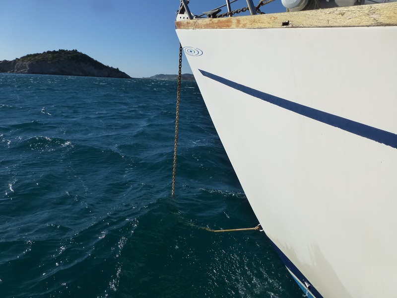
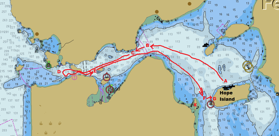
We used a Claw anchor until very recently, but the Vulcan is way, way, way better. It’s pretty amazing, but still not flawless. In the PNW, if an anchor drags at all (2-3 feet, even) the throat of the anchor loads up with kelp and won’t dig in and set. Then you have to raise the anchor, clean it out, and try again. Because of tides and currents and wind and weather, you can expect to swing on the anchor almost constantly, so a GPS anchor watch is important. Successful anchoring looks like a ball of yarn.

We carry 8 feet of 3/8 chain and about 150′ of 1/2 nylon 3-strand rode. We also have, I think four spare anchors and a couple spare rodes.

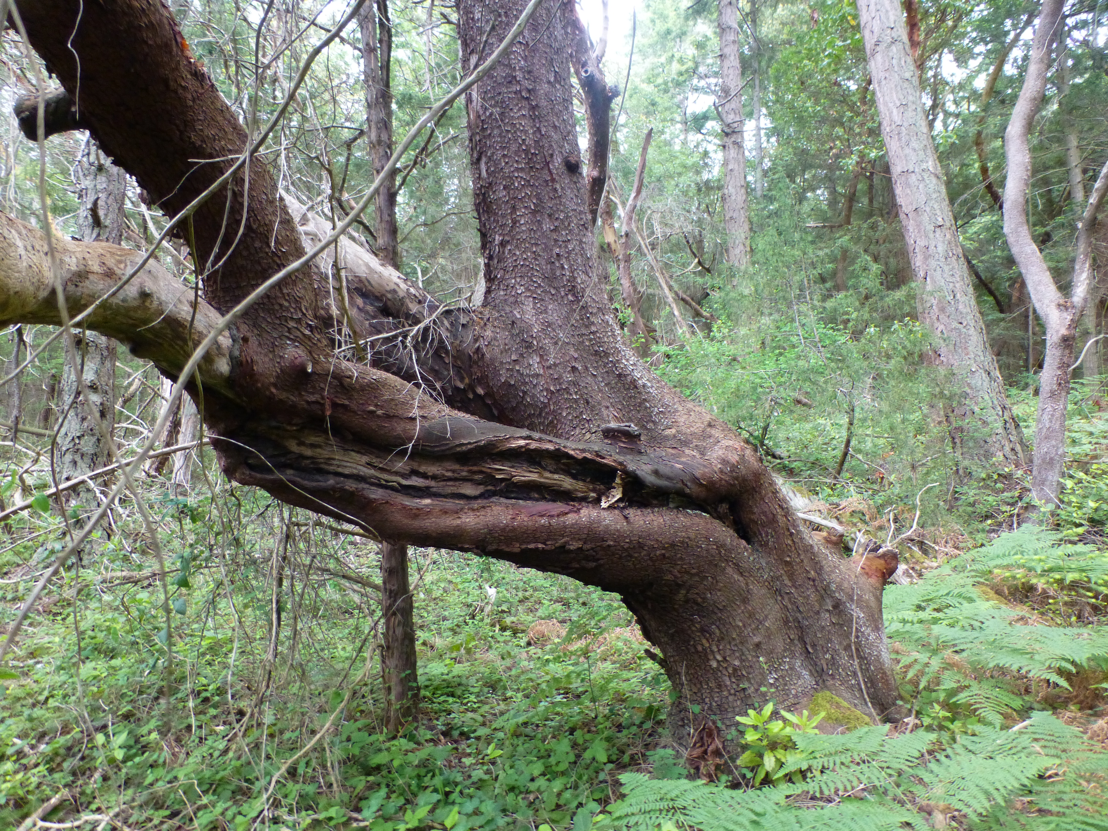
When conditions are right, mostly in Canada and mostly in Desolation Sound, we tie the stern to shore. This makes anchoring much more secure. You need to pay attention and allow for the tides. Sometimes there are actual shore anchors, installed by other boats or left over from logging operations. Other times you throw a line around trees or big rocks. Recently Nancy started swimming the line to shore, which is way easier and faster than using the dingy.

The view from the helm shows (left to right) the RADAR, depth sounder (with fuel flow meter), GPS, Autopilot, Compass, and anti-fog rag.

On the hardtop over the cockpit is the 100W solar panel (MPPT controller is in the cabin) and the radome. We also carry two small sit-on-top kayaks. They’re light and a lot of fun. At anchor, we have a solar shower that sits up here for a quick warm rinse after a swim.

We bought the RADAR pretty early on when we almost drove between a tugboat and it’s barge tow in a medium fog. It’s really a great thing to have.

Down and to starboard, under the dinette settee, is the engine coolant/water water heater (120VAC also). Two group 27 AGMs for house batteries, with the switch and current/state-of-charge meter and isolation switch. This year we’re switching to a LiFePo 100Ah battery that we’ll share (move to and from) with the Sprinter RV.

Electrical Use Ah/24 hours:
Refer 20
Movie 5
Laptop 2
Misc. 1


Total = 28 Ah per day. We get about 20-21 Ah from the solar panel, meaning that we net lose about 8Ah per day. We make that up by running the motor. The new battery should make this better because it charges more efficiently.

Making one big square ice cube uses 0.7 Ah.

This junk gets packed around the batteries and water heater. Mostly tools.

Down and to port is the head.

The dinette is further forward to starboard, with the radio and some storage outboard. It also made a very comfortable double bed for us back in the day when we’d pile the kids and the dogs into the Vee-berth.

A propane catalytic heater stores under the dinette. It’s not the perfect solution, but it stores well and works when we really need it. There’s a ton of food storage under the floor here, and clothing storage inside the forward settee.

Forward to port is the Galley with pressure water, an alcohol “puck” stove (which is great), and a compressor-based 12V Novacool R2600 refrigerator. There was a microwave, but we removed it to claim the storage space (and because we almost never plug the boat into shore power). The shattered glass stove top has been replaced with an aluminum plate. We have a faucet-mounted water filter for drinking water/coffee.

We carry a couple of cases of bottled water in case the 20G water tank goes fouled. We also carry an AquaResearch H2Go water purification device to sanitize water we get from streams and other dubious sources (especially in Desolation Sound). We carry two additional five-gallon water totes for hauling water and when we want more storage. https://store.h2gopurifier.com/products/h2go-purifier-global

Sometimes we beg water from our neighbors in the anchorage.

This is the stuff we store in the V-berth area. There’s also a TV with movies and a homemade (Raspberry Pie) AIS receiver/chart plotter system.

The front of the boat (the bikini deck) is a great place for afternoon snacks.

We made some window shades for a planned trip through the US inland waterways. We went to Mexico on Bright Water, instead, but the sunshades are still pretty great and don’t weigh much or take up much room.

We no longer own a barn in the PNW to store TIDEPOOL in, so we have to rent some barn space at a local marina. It’s working out well, so far. The boat sits on it’s trailer, is plugged in for battery health and moisture/mildew control, and it’s safe from the weather.

The storage yard has a work area where we can go through everything before and after a trip. EZPeazy.

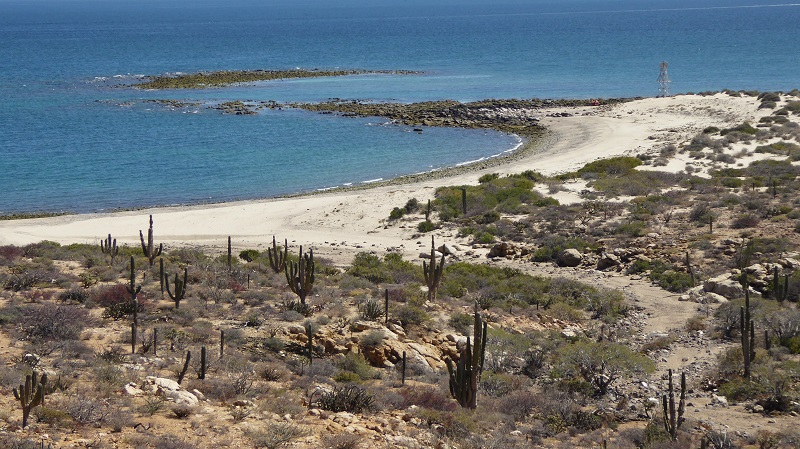
The Pacific Northwest is a great place to go boating. Desolation Sound, in British Columbia, has the warmest water north of Mexico. It’s a great place to spend the end of summer. Here’s a time-lapse (four weeks in four minutes) video from 2011: https://www.youtube.com/watch?v=3TGs7PIUJHo

Here are the checklists:

Here is the packing list:

Kayaks in Distress

So we took TIDEPOOL out for our annual mid-May shakedown cruise. The weather forecast was imperfect, so we didn’t go far and we ended up tied to a mooring on the north side of Hope Island, a WA state park north of Camano Island and inside Whidbey Island. As usual, we were the smallest boat in the moorage.

P1050736

We tied to a mooring buoy, had lunch, and sat around. Then we took the dinghy and circumnavigated Hope Island. Then we sat around for a while. It was pretty quiet except for the F/A 18 Super Hornets buzzing around.

P1050769

They’re cool. Anyway, it was quiet. The the VHF radio made some noise, which almost never happens anymore because nobody uses the radio. Everyone talks on their cell phones. Some guy was saying some stuff. It was all very weak and noisy, but then I heard “…kayakers in distress…” and I started paying attention. The water here is 55 degrees and for some reason there’s a lot of beginners in the area. It’s easy to get here, I guess. But if you fall in and panic you can die in about 15 minutes. If you don’t panic it takes slightly longer. 55 is cold. You can’t breathe.

So I called on the radio: “Kayakers in distress, TIDEPOOL. What is your location?”

Noisy static in reply “…swept away in the current…” and more noise.

“Kayakers in Distress, TIDEPOOL. Where are you?”

“TIDEPOOL, I’m not in a kayak,” clear as can be. “I’m watching…” …noise….”…lan spit….”

Kayakers in distress, TIDEPOOL. Say again your location.”

“Alan spit.”

“Where?”

“Lan spit.”

“Where’s that?”

(noise)….”(inside) or (east side) noise “…ception Pass….” noise.

Deception pass is a wicked dangerous area with huge currents and whirlpools and kraken. It was three miles away. Nancy and I pulled the dinghy onboard, untied from the buoy and started north at 30 mph.

Hope Island 20200518

We left from A and ran to B and stopped. We had heard some radio traffic, but we can’t understand it while we’re running. Also, B is the first place where the current really matters.

“Kayaks in Distress, TIDEPOOL. Where are the kayaks in distress?”

Noise. Noisy noise. “…spit.” Noise.

So we headed for the pass. As we were climbing on plane, we heard a very clear call, so we stopped again at C. “Station calling TIDEPOOL, this is TIDEPOOL.”*

“TIDEPOOL, be advised that the people that live around here see a lot of kayaks in the water and call in a lot of false alarms.”

“Yeah, any idea who he’s talking about?”

“Negative, TIDEPOOL.”

“Did you hear the location?”

“Negative, TIDEPOOL.”

“I’ll keep looking then. TIDEPOOL out.”

Then we got a different call.

“TIDEPOOL, United States Coast Guard.”

So we talked to the Coast Guard for a while. They wanted all the details. We told them what we knew. The USCG didn’t know where Alan or Alain Spit was, either.

So we motored through some fishing boats and out through Deception Pass to D. There was very little current and no kayaks anywhere near the pass. As we accelerated back onto plane and turned around, two boats ran towards us from the northwest. One circled the island inside the pass and went back out, another passed us, then stopped and pulled next to us once we got back inside the pass.

“Did you find them?” they yelled. We hadn’t, of course. They’d heard our broadcast and came to help. So had the other boat, apparently. Then they took off.

There were two guys fishing from kayaks at E. They were fine and hadn’t seen anybody in trouble. While we were talking to them we got another call from the Coast Guard. No, we hadn’t learned anything new, but Nancy heard him say that the spit across from Hope Island is sometimes called Ala Spit. I didn’t understand that part, but Nancy did.

So we got up on plane and ran back to Hope Island. We heard some radio chatter on the way, but kept going. We didn’t see any kayaks in distress.

When we got back to Hope Island, there were four kayaks crossing over from the mainland (F). The water runs pretty good through the narrows, but it’s not a dangerous spot. There’s plenty of calm water on either side of the flow. It’s like a tide rip — you paddle across the flow, then upstream once you’re clear of the current. But we stopped and talked to the last guy anyway. He was actually in a bit of distress. He’d been fighting the current and didn’t think he was making progress. His buddy, 50 yards in front of him, yelled that they were fine and didn’t need any help. I told the guy that he was getting help anyway, because the Coast Guard was already involved and things needed a conclusion. So we dropped the dingy in the water and towed it to the last kayaker (like a water ski pickup). I told him to crawl into the dingy and wait there while we catch his buddy. The the coast guard called again. I told them we found some people to help, and we got a phone number to call once things settled down. Once we stopped talking to the USCG, we turned around and our new hopefully not contagious passenger was in the cockpit of TIDEPOOL, his kayak drifting away. So we turned back and captured his kayak (and his phone, which was in the bottom of the his kayak). They we started after his buddy who by now was making progress and was almost out of the current.

The buddy picked up speed. He didn’t want any help. So we followed him in for 15 minutes or so, then we stopped right off the beach, got our passenger back in his kayak, and watched him paddle the last 50 feet to shore.

So once everyone was on shore (G) – 4 guys total (two were way ahead of the other two) the Coast Guard called again on the radio. Switch to Channel 21A, number of people, what they were wearing, color of the boats, their condition, etc. Then he wanted to know the name of the boat that made the distress call. “I don’t know,” I said. “I think it was somebody on shore. The signal was very weak, then he stopped answering my calls.”

“Roger, TIDEPOOL, Coast Guard out.”

“I’m him. I’m the guy.” And he’s back. So now the USCG wanted to talk to the guy on shore.

Then the helicopter arrived. Cool.

The Coast Guard was busy talking to the on-shore guy on the radio (channel 21A), and I couldn’t hear him very well, so I called the Helicopter on 16, which was fun. He was about 200 feet directly above us.

“Coast Guard Helo, TIDEPOOL on 16.”

“TIDEPOOL, CG Helo.”

Did they see the guys on shore, did they see anyone else in the area, can I give them any more information, why are they still here, etc.

“We’re waiting to be cleared by base.”

“Coast Guard Helo, TIDEPOOL. Roger. Standing by on 16”

So then I called USCG on the phone and made sure we were done. Then we were done.

We went back to the mooring and had dinner. We’re still kerfuffled by the whole thing, because it was a waste and a mess but you don’t want people ignoring trouble, either. The only thing that might have saved it would have been if the guy on shore had called 911 in the first place then the response would have been managed by the Sheriff or USCG from the start. That would have been better. Also, if he had said the kayakers were crossing to Hope Island everyone would have know where that was.

By the way, the feature marked X on the chart is called Ala Spit in our thirty year old Marine Atlas, but it’s not listed as a place name in the index, so we didn’t find it. On modern charts, including our electronic charts, it’s called Ben Uri Spit. Just to make it all more stupider, the island just south of E on the chart (three miles away) is called Ben Uri Island. So that’s fun. Good luck in the next exact same rescue situation.

The next day we hiked on Hope Island. It’s a pretty place, if you like trees and flowers and stuff.

P1050760P1050757P1050751P1050747P1050750P1050755P1050739P1050738P1050724P1050773


The Reviews are In!

We gave our boat show talk at the Big Seattle Boat Show on Wednesday. Amazingly, the room was full, and the results are in.

The people who were disappointed with the talk failed to fill out survey forms, so they don’t matter. Those who voted loved the talk, with 44/45 points awarded. The most constructive critism was that we should include better information on communication and weather data. Unfortunately, our advice to research Iridium puck systems, and probably install a SSB radio, and for sure get a SSB receiver, is the best we can do. Everything is changing too fast.

Others asked for a bigger screen and more chairs. That’s cool.

Nobody asked for more cowbell.

COMPREHENSIVE REVIEW OF RECENT SURFACE FORCE INCIDENTS

The United States Navy has had some difficult times this year in the Pacific, with three collisions and a grounding. They just released an astonishingly candid account of the incidents that is worth reading.

http://s3.amazonaws.com/CHINFO/Comprehensive+Review_Final.pdf

Both fatal collisions were due to issues directly related to recreational boating.

The USS John McCain ran into a freighter because (among other things) there was a confused hand-off between different control stations. Several years ago, a boat screamed into the anchorage at Sucia island at high speed, then ran over and got stuck on an anchored set of mooring lines.

Excell on Spar 011406

The new captain had driven his new boat from Bellingham using the flybridge controls, then came below to attempt to moor. He was unable to switch control authority in time to avoid driving right over two very large, very tight ropes that ended up between his props and his rudders.

I was about to use a hacksaw to cut the lines and free him when the park service finally showed up.

In the USS Fitzgerald collision, the watchstanders failed to correctly identify and avoid other vessels in a complex environment. Our sort-of-modern commercial radar and AIS system does that all automatically for us, but the Navy bridge upgrades have been spotty and non-organized due to funding and other issues. A mess.

ShippingB

https://svbrightwater.wordpress.com/2012/10/13/constant-bearing-decreasing-range/

Please read and review Jimi & Isaac Books!


Safe Drinking Water

Tags

, , , , , ,

We made our own water in Mexico, using a reverse osmosis (RO) system. It’s like a very, very fine filter that filters the salt (and everything else) out of sea water. RO uses a lot of electrical energy, but if you plan for it, it’s not a big deal.

We met a few boats that filled their tanks periodically, which is also not a big deal. Water sources are about 120 miles apart, so plan accordingly. Obviously, those boats did a lot less washing than we did.

We also met and heard of way, way too many boats that got sick from bad water. Bad water is almost completely preventable. If you add chlorine to your water, you won’t get sick. If you don’t add chlorine, you’ll eventually get sick. Iodine doesn’t actually work — it’s not chemically active enough. Filters and UV treatments don’t work. UV won’t work where the light don’t shine, and filters only work until they get full (clog) or the filter gets changed without bleaching everything. Then they fail, and then you get really sick because all the contamination imbedded in the filter washes downstream.

So, first you need to clean (shock) your tanks. This is a highly speculative process, and it depends on how dirty your tanks are. If you keep your tanks clean, then you have less to do. We would add 2 cups of bleach to ten gallons of water at the beginning and end of each sailing season. Poor the mixture into (each) tank, bleed every faucet and hose bib until you smell chlorine, then leave it sit for at least 24 hours or until you return to the boat. Then run the system empty, add more water, and flush the system. Since our water tanks are clean, we left the tanks empty except for the bleach mix when we were away from the boat.

When you add water from a hose (from a roughly clean source), add one teaspoon of bleach per ten gallons of water, or one ounce of bleach per fifty gallons of water. If you’re adding water from a clear stream (in Desolation Sound, for instance) add twice that amount (note that the chlorine still won’t kill Giardia).

Since we knew our RO water was sanitary and safely handled, we added about half that dosage to our water tanks. The chlorine smell was almost always negligible. In addition, our RO system pumped into a smaller drinking water tank first, which we didn’t chlorinate except at the beginning and end of the cruise (or every five-six months of continuous cruising). You can also use a carbon filter to clean up your drinking water.

If you come into any kind of contact with people that have had digestive problems, wipe your boat interior down with bleach water (not a lot, but it should smell a little). Bleach water is also the best solution for mildew and mold, although vinegar works a little.

If you don’t want to deal with bleach bottles, or if you want to deal with something cooler than bleach bottles, then you need this—> H2gO-PRIME-5-ppm-device_1024x1024The h2go purifier turns water and salt (or seawater) into a concentrated sterilizing solution that works like nothing else. It even kills giardia. And…solar power! That’s right. And…a flashlight. I can’t believe you haven’t bought one yet. Go buy one now!

People seem to be afraid of chlorine. They shouldn’t be. They should be afraid of cholera, shigella, legionella, giardia, campylobacter, norovirus, salmonella, cryptosporidium, et. al. Also, living full-time long-time on RO water has it’s own risk — mineral deficiency. A daily mineral tablet will do you no harm, and make sure the kids are using fluoride toothpaste. Their teeth will thank you.

Some older boats and RVs were plumbed with polybutylene (PB) pipe, which will fail when exposed to chlorine. It’s probably already failed. Make sure you use PEX when you re-plumb your boat.

Resources:

https://www.cdc.gov/safewater/chlorine-residual-testing.html

Click to access 09_202278-B_Make_Water_Safe_Flyer_508.pdf

Click to access CL2Chemistry.pdf

Click to access Health%20Manual%20CH6.pdf

Click to access nutrientschap12.pdf

H2gO PRIME

Boat on a Ship.

Tags

, ,

Tomorrow, Easter Sunday, Raven Marine will lift Bright Water onto a ship, secure it, and deliver it to Victoria BC (or equal) for offload.

This is not our ship, but this will give you the idea:

P1110592

Our ship is the Yongxing, out of Hong Kong. You can follow it’s progress here: http://www.marinetraffic.com/en/ais/details/ships/shipid:687641/mmsi:477450000/vessel:YONGXING

The ship will stop in Ensenada, Mexico, and then cruise past the entire west coast of the US to Canada. I think it can’t stop here because of the Jones Act.

With some luck and planning, Nancy and I will be there for the off-load.

Yes. It is terrifying. We’ll see.

2017 Anacortes Boat Show – Cruising in Baja

This is our forty minute boat show talk. If you want more information, use the search feature of this blog. If you want us to come talk to you or your group, send us an email or comment on the blog.

A Bright Water Logo

Howdy. We’re Phil and Nancy Rink.

AA DSCN1263

We’ve been boating in the Pacific NW our entire adult lives, starting with a 15.5 Hourston Glasscraft with a 65hp Evinrude in 1985. AB Hourston 15 5

We’ve had several boats since then, including a Bayliner 2452 AC DSC08080

and a 55′ Ocean Alexander Mark 1.AD Rockfish cruise kelp cormorants

In 2001/2 we pulled our kids out of school for a year, bought a Beneteau Oceanus 400 in St. Martin, and cruised the Caribbean for a year.AE dtp_392995_USER_CONTENT_0_pic000F

In 2012, with our children grown and not yet making grandchildren, we bought a 46′ Cal 2-46 motorsailer, BA

renamed it “Bright Water,” and prepared it for an extended cruise of the Pacific Ocean.BB Masttop 29102016

The motor is much more important to us than the sails. We call Bright Water a trawler with a stick.BC P1070547

The boat was a bigger mess than we thought, and we ended up doing a top to bottom refit. CA DSC09387

We ended up rebuilding or removing and replacing almost everything. We installed new tanks,CB DSC09417

plumbing, windlass, CC P1060286

standing and running rigging, CD

electrical, electronics, CE DSC00147

soft goods, windows,CG P1060237

galley equipment, refrigeration, CH P1060241

engine, transmission, shaft,CI DSC09215

and prop. OLYMPUS DIGITAL CAMERA

We crammed a man-year of work into about four months, and escaped the Straight of Juan de Fuca in mid-September just before the fall weather closed in. DA DSC00122

Boats that left two weeks later were hit by significant winds and high seas, but we motored to Coos Bay, Oregon in calm but dreary weather. DB DSC00225

We anchored in the river just inside the bar for almost a week waiting for another weather window, DC DSC00242

then motored in more calm but dreary weather to Drake’s Bay just north of San Francisco. DD P1000069

From there it was a series of small, controlled steps down the coast DE P1000238

to the safety of San Diego, where we anchored for about two weeks, DF P1000358

finishing projects and waiting for the end of hurricane season in the tropical Pacific ocean.DG

We left San Diego at the end of October, just ahead of the Baja Haha fleet, cleared Mexican Customs in Ensenada, EA P1000490

and continued to avoid the Haha-ers on our way down the coast, stopping twice on the way, and tucking into Turtle Bay to get GRIBs. EB P1000521

We finally arrived in Cabo San Lucas ten days after leaving San Diego, EC

and headed directly around the corner and north into the Sea of Cortes. ED P1000724

We ended up skipping the Pacific and staying in Mexico for the next four and a half years, exploring the Gulf of California and Pacific Mexico. We’re done now, and Bright Water is for sale and on a ship headed for the PNW. We’d like to tell you about our trip.EE P1090548 (2)

The Sea of Cortez is about the size of the Salish Sea, but the water is much, much more open and there are a lot less places to anchor.FA salish-baja

The common cruising ground from Loreto to La Paz is about the same size as Puget Sound.FB puget-baja

We went as far south as Tentacatita on the mainland, so we cruised an area comparable to the Seattle/SE Alaska trip. FC pnw-mexico

Again, the water is bigger and the anchorages are farther apart. We had crossings and passages on pond-calm water, but we also spent more than a few days in winds considered “stormy” in Puget Sound.

FD P1010708

We cruised the sea for five separate trips, ranging from two weeks to eight months. In between, we left Bright Water in Marina Seca Guaymas on the mainland, hauled out and on the hard. Guaymas is a 30 hour drive from Camano,

GA P1000979


and the car was usually full in both directions as we continued to finish projects and refine our cruising equipment. We have never regretted staying in Mexico instead of cruising the Pacific.

GB P1010063


The most important thing you need to know about the Sea of Cortes compared to the Salish Sea is that Mexico is big water.

HA Mexico Map


The Sea is 100 miles across or more. Fuel stops and groceries are 120 miles apart or more, but both fuel and food are high quality and safe.

HB P1060235


Anchorages are far apart, and very, very few are “all weather.”

HC P1080668


You need to be both self-sufficient and you need to rely on your fellow cruisers for help when needed. You need to pay constant attention to the weather forecast and seek out the best information you can find. Safety depends on constant, active choices.

HD P1070997


Charts in Mexico are mostly guidelines, like the pirate code. Paper charts are roughly useless. We relied on our electronic charts as general guides, the cruising guides for specific locations,

IA P1010339


and radar overlay as crucial.

IB P1010337


On our OpenCPN PC we could view GoogleEarth captures, which indexed correctly. The pictures were often great references, although there were still surprises.

IC Balandra Earth


The XXXX’s show an unmarked reef we discovered on this small island in the northern sea. We missed it, but not by much.

ID Isla Partida


Anchoring gear is always crucial. We found ourselves in winds of over 60 knots for hours and hours as weather passed through,

JA P1080976


but we knew that we could mostly trust our 30kg Claw, 5/16 chain, and water-line attached nylon rope snubber.

JB P1040131


We drug anchor once after anchoring in too-shallow sand, but we saw boats drag many, many times.

JC 28Jan2017 anchor Drag 450 feet 4 minutes


We almost always avoided the “safe” but crowded anchorages. We feared other boats more than we feared nature.

JD P1050624


Weather forecasting is crucial and problematic. Somebody reads their favorite forecast on the morning radio nets, mostly, but not always.

LA Bright Water Splash


If you have cell service you can get any of the various weather products off the web. We prefer to harvest emailed GRIB files from sailnet, that we analyzed and track using OpenCPN, but problems with cellular and Iridium email made that less reliable in the recent past.

LB Grib 17022017 1400


With reliable SSB/Pactor modem gear, you can get a daily GRIB files that’s as accurate as any other source. For sure, the more detail you have in your forecast, the more confidence you’ll have in your movements.

LC Grib 18022017 1400


We like a lot of detail. There are plenty of people, though, that either use the morning nets, gossip, or nothing to deal with incoming weather. They cruise the sea, too, and seem to live to talk about it.

LD Grib 05032017 0200


Baja California is relatively uncrowded and crazy crazy pretty. The climate in the summer is every bit as nice as the Caribbean and the Bahamas, and in the winter it’s very similar to summer in the Salish Sea.

MA P1050811


The desert is red rocks

MB Gatos


and rugged, brand-new tectonic and volcanic geology.

MC P1050546


There’re coyotes on the beaches

MD P1000946


And goats

ME P1050299


and vultures,

MF P1010146


Pelicans and cormorants and frigates and boobies in the sky.

MG P1060511


There’re California Sea Lions and dolphins and turtles of every size and shape.

MH P1050644


One day this year we saw seven Blue Whales in an hour.

MI P1030535


There’s lot’s of fish and there’s no ciguatera, so you can eat almost anything you catch.

MJ P1010818


There’s coral,

MK Brain Coral San Telmo


Rhyolith, and

ML Rhyolite


rock reefs to snorkel and fish on,

MM Rock Reef


and hiking up a deserted arroyo is almost always an incredible way to spend your day.

MN P1090621


In February, 2014 we took the boat back around the southern tip of the Baja Peninsula and a day and half up the coast to Mag Bay.

OA Mag Bay Map


We spent a month as the only cruising boat exploring the bay, which is huge.

OAA P1010313 (2)


We had miles of incredible beach to ourselves,

OB P1000761 (2)


we walked a mile across sand dunes to the roughly un-visited southern beaches of Bahia Santa Maria,

OC P1000796


and we spent days in the dinghy waiting for oxytocin-laced mama grey whales to show us their babies.

OD P1000650 (2)


We drifted in our tiny dingy with the motor silent,

OE P1010131

and our life jackets on while the moms and their babies swam towards the dingy to have a look at us.

OF P1010138


It was truly amazing.

OG P1000646


We left Mag Bay and sailed straight for Tenacatita on the Mexican Riveria. The trip was relatively uneventful except for the remarkable fishing

PA P1010496 (3)


and a small accident with a very large dorado that escaped by wiggling overboard after transferring the fishhook to Phil’s foot.

PB P1010527


Tentacatita and nearby Barra de Navidad are the winter homes for approximately 100 boats that migrate south every year from San Carlos and Guaymas. Robert and the lovely Miss Virginia host a “Mayor’s Raft-Up” every Friday evening in Tentacatita,

QA P1010832


with a potluck, lively discussion, and a sing-along.

QB P1010889


It’s a fantastic, magical place full of great people and a daily swim-to-shore, beach boccie-ball, Mexican train dominoes, and beach walk.

QC P1010809


After three weeks in Tentacatita, we moved north to Banderas Bay where we discovered the San Diego yacht club was setting up the finish line for the San Diego to Puerto Vallarta open-ocean sailing race right off our stern.

RA P1020510


We appointed ourselves as the official spectator fleet and dinghied over to see what was what.

RB P1020841


They put us to work and we had a great time helping with record-keeping

RC P1020661


and passing out swag.

RD P1020819


They even invited us to the closing dinner. It was an amazing event,

RE P1020940


and the boats were completely astonishing.

RF P1030397


One of the things that’s amazing about Baja California is how un-crowded it is. This year we spent 32 days on a two-mile sandy beach just outside of La Paz.

SA P1110007


There was never more than three other boats in the anchorage, and we had the place to ourselves for a dozen of those days.

SB P1100205

(We now open a slide show of about 150 pretty pictures, mostly from this blog, while we each discuss our three things we want you to know).

Nancy Three Things:

Marinas:

5 towns with Fuel and Food, space about 120 miles apart. Moorage is approximately the same as in the US.

Anchoring:

Cruising Guides w/ GPS locations.

Discomfort = places to yourself

Good Holding Sand

Mostly Free, but Dinghy docks have a slight cost.

Provisioning:

8 week provisioning plan on the blog.

You can get almost anything in La Paz that you like.

Mainland not as easy for American things.

Fresh is easier on the Mainland.

Costs about the same a here, maybe a little less.

Communications:

VHF is local and important. There is usually a morning VHF net in every major anchorage.

SSB/HAM. There are two morning nets. This is how the cruisers communicate. With a pactor modem, this is the best way to have reliable communication and get weather (GRIB files).

CELL service is getting better all the time in Baja, but is mostly only available near Loreto or La Paz, as well as Guaymas/San Carlos. There is some service near Muertos/Frailes, and there’s service in Cabo and the East Cape as well.

Satellite phone should be better but was a problem for us. The Iridium “puck” based systems seem to be working now, maybe. Some support email and GRIBS, some only do SMS and proprietary weather. Satellite texting (SMS) is the most reliable contact with the outside world.

If we did it again, we would install a SSB/Ham Radio with a Pactor modem.

Phil Three Things:

We made our own water and had no troubles, but we constantly heard of boats and groups of boats dealing with diarrhea from contamination. We’re roughly experts at this subject, and want to be completely clear that chlorine is the only way to keep your water tanks safe. Filtration systems help, but they’re not enough. Boats with or without water makers do fine as long as they maintain a chlorine residual. Even if a marina or a community has RO water, they still don’t maintain positive pressure in their systems because Mexican power is not reliable enough. Once the pressure drops, water from outside sources can be sucked into the distribution system and contaminate the source. Then bad things happen. We also recommend carrying several cases of bottled water, at least in the early months of your cruise. It costs almost nothing and guarantees safe water if you have a problem early on.

In our opinion, once you get south of the border area, Mexico and especially Baja is safer than the USA and Canada. For our own comfort, we almost always tried to be back on the boat before dark (remember we almost always anchored out). In most remote anchorages, the only other boaters you see are local fishermen and other cruisers. In contrast to the Caribbean, we saw almost no derelict cruisers, and we never had a bad experience with the fishermen.

If there is a problem, it’s very difficult to recover in Mexico. They have no functioning national mail or shipping system. There are private companies shipping to and from the US from La Paz and other cities, but you can count on a week or more or never to get anything in from the states. Even on the mainland, small stores would have a guy that would drive the sixteen hours round trip to Phoenix once a week to pick stuff up. That worked if he got through customs cleanly. We lost an ATM card to the machine our first hour in Guaymas. We didn’t even try to get a new one. We weren’t worried about pick-pockets in any real way, but we kept very close track of our cards because replacing them would have been a nightmare.